3D Mapping in Physical Security Protection
Enhanced Situational Awareness
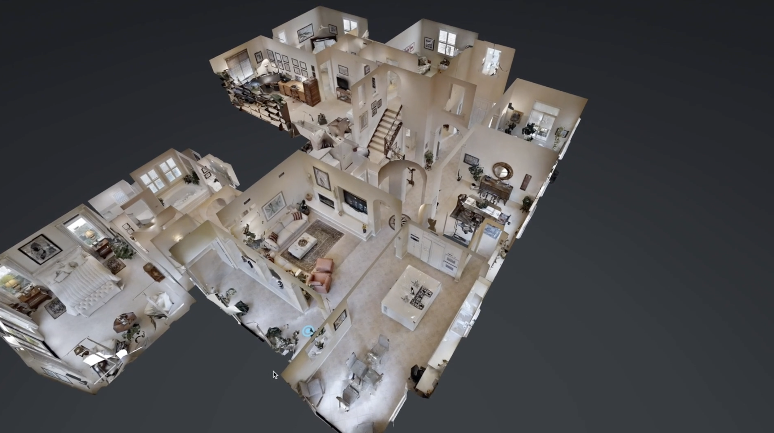
3D mapping provides a realistic, immersive view of a site, allowing security teams to visualize terrain, structures, and potential vulnerabilities with greater clarity than traditional blueprints or flat diagrams.
Accurate Site Assessments
With precise spatial measurements and real-world modeling, 3D maps enable more accurate placement of cameras, lighting, barriers, and personnel, reducing blind spots and improving coverage.
Virtual Walkthroughs for Planning
Security teams and clients can conduct virtual site tours to identify risks, plan responses, and rehearse operations before stepping foot on-site, improving readiness and decision-making.
Improved Client Communication
A 3D visual is more compelling than technical reports. It helps clients clearly understand your recommendations, building trust and setting your firm apart from competitors relying on outdated visuals.
Custom-Tailored Security Design
3D models allow for simulation of line-of-sight, intrusion paths, and escape routes, helping design security systems that are custom-fit to the unique layout of the property.
Integration with Other Technologies
3D mapping can be layered with CCTV coverage zones, motion sensor fields, and access control points—making it a versatile platform for comprehensive digital site analysis.
Marketing & Differentiation
Firms using 3D mapping in proposals show a commitment to innovation and precision, helping attract higher-end clients and win contracts in competitive markets.